Union Pacific's Rock-filled Causeway.
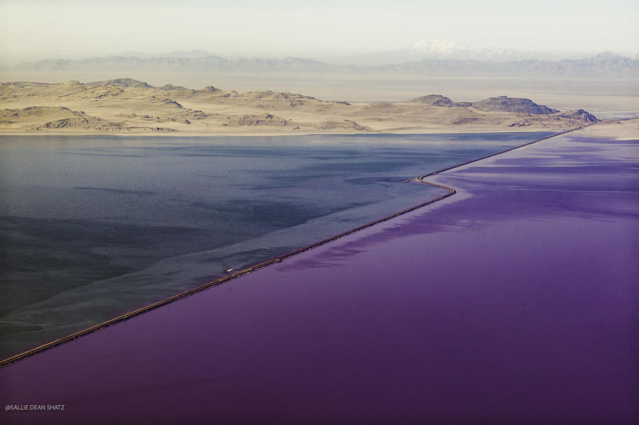
The causeway stretches 20 miles across the Great Salt Lake dissecting it (you can see it in the satellite images to the left.) The causeway was built with two bridges that water could flow through. It has been used to cut off the access of water between the north and south arm sacrificing the north arm to save the ecosystem of the south arm. The south arm has more fresh water flowing into it from the mountains than the north arm. The salinity of the north arm is currently 34%. The current salinity for the south arm is 11.2%. For reference oceans are 3% salinity. The color of the north arm changes by season with the growth of archaea as seen in some of the other images in this exhibit. Note the archaea (pink) seeping into the south arm along the causeway.
On the day this photo was made, the pollution inversion was obscuring of the foothills, Death Ridge and Desert Peak in the background.
|
|